")
Canyonlands is a sprawling national park. It has three distinct districts, separated by great distances. There is no way you can see all three in a single day. Staying in Moab is the best way to experience the two most popular. Even still, you have to do some driving.
The distance between the Island in the Sky and Needles districts of Canyonlands is over 130 miles. From Moab alone, it took us 1.5 hours south on Hwy 191, then west on Hwy 121 to reach the Needles visitors center. Island in the Sky is in the opposite direction from Moab, another hour from there. Island in the Sky affords panoramic, spectacular views of the canyons from vistas along the high plateau. Needles is lower in elevation and has trails that get you up close to many interesting rock formations, including arches, spires and domes.
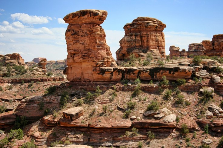
What makes the rocks at Needles interesting are its alternating layers of contrasting colors, red and white, both Cedar Mesa sandstones formed from two different sources of sand that was deposited here over 250 millions years ago. About 15mya, uplifts caused the Cedar Mesa sandstone to crack and form square joints that water later penetrated and eroded into the current pillar and spire shapes.
The Needles has many trails, some very short, others much longer that require overnighting. We only had time for the short ones.
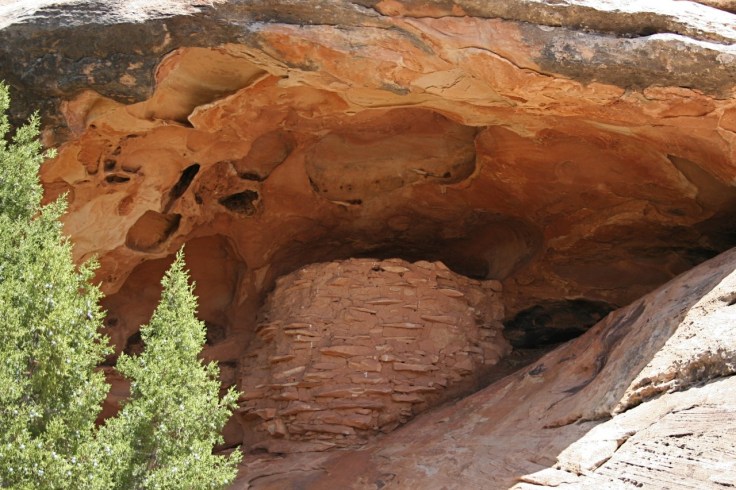
The Roadside Ruin trail, only 0.3 mile long, led us past an ancient granary nestled under an alcove, which you cannot approach except by camera.
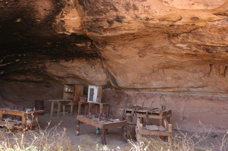
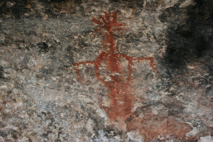
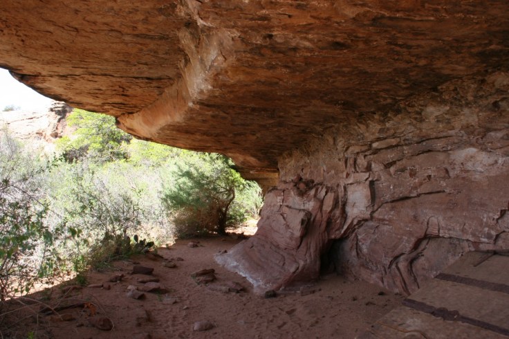
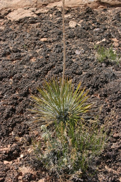
The Cave Spring Trail is more interesting, only because you can walk up to ancient Indian rock art and cowboy camp exhibit, both under large, cave-like hollows in the mushroom-shaped rock formations. The caves not only supplied shelter but were important sources of water that was captured and percolated through the sandstone after rains. The camp, similar to others like it, provided a comfortable environment for cowboys who could spend months tending to their livestock in pasture. Many of the original furniture and implements are still on display. The loop trail (0.6 mile) includes two ladders that you must climb in order to complete it. The trail also goes past interesting rock pillars, desert plants (including the yucca, a most important resource for the ancestral Puebloans) and cryptobiotic soil. The last portion of the trail finishes over hard slickrock that provides views to the surrounding scenery and mountains.
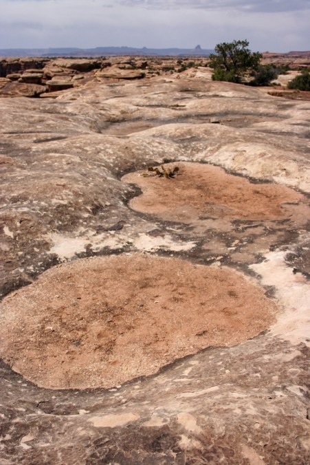
Potholes are featured along the Pothole Point Trail (0.6 mile) that were formed on the slickrock by abrasion, erosion and water. Potholes are basins or depressions in the sandstone where storm water can collect, providing an enclosed ecosystem for tiny crustaceans and toads whose life cycles are compressed to the time it takes for the potholes to dry up. In other words, these buggers have to get down in a hurry to procreate. Remarkably, they lay drought-resistant eggs that wait for the next rainstorm.
At the end of these short hikes, we piled into the car to make the drive back to Moab. The longer hikes in the Needles district promise more spectacular rewards, but these will have to wait for another time.

Leave a comment