")

There is a gaping hole in the earth at the end of the west fork of the Island in the Sky scenic drive. An enormous crater lies ominously in one section of Canyonlands National Park. Upheaval Dome (above) was long thought to be a collapsed salt dome, but many geologists now feel that it is a meteorite impact crater that struck 65 million years ago, which would date it to the extinction of the dinosaurs. It’s hard to imagine what an impact like that would have on life as well as the surroundings. The entire crater is hard to see from the two lookout points close to the parking lot, but a loop hike around the rim provides a better sense of its size. Aerial photographs clearly dramatizes its immensity.
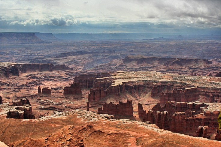
Near Moab, Canyonlands is a showcase for thousands of canyons carved by the Colorado River and its tributaries. The park is divided into three districts roughly defined by the Colorado and Green Rivers which converge from the northeast and northwest, respectively, to become just the Colorado in the form of a giant “Y” (as this Google map shows): Islands in the Sky in the center of the “Y”, the Maze to the left and the Needles district to the right.
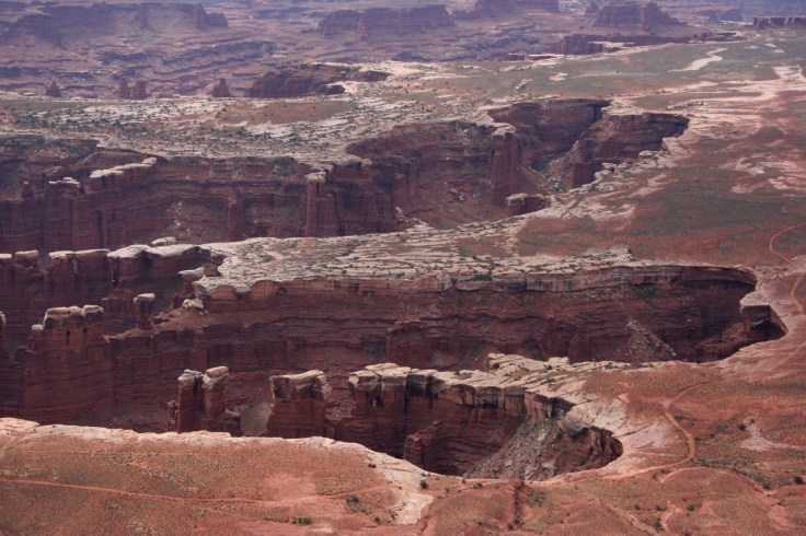
When you gaze at the canyons from the park overlooks, they look as if they were formed suddenly. For instance, the plateau beneath the Grand View Point Overlook seems like it collapsed in places to form the deeply incised finger canyons. The lightly colored plateau was made possible by a relatively hard white sandstone that caps the softer Organ Rock formation beneath. Further afield, looking down to the Colorado River, it isn’t hard to imagine that a tremendous force of some kind caused an implosion to create the outlines of what we see today, perhaps the meteorite that created Upheaval Dome not far away. The current accepted theory is that erosion over millions of years carved out the valleys.
The park is not visited nearly as much as, say, its neighbor to the south, Arches National Park, but not for the lack of natural wonders. Its remoteness is much to blame; there are no accommodations, other than campgrounds, within 30 miles of the park entrance to Island in the Sky or 50 miles of the entrance to the Needles district. The Maze district might be the most inaccessible area in the U.S. park system. The park’s isolation alone makes it hard to experience any of the its districts within a single day and precluded our taking several more of its hiking trails.
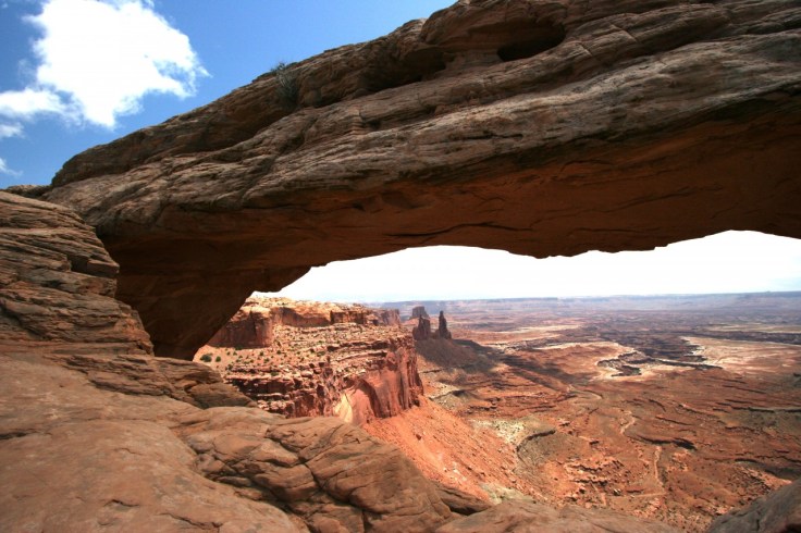
One of the world’s most photographed arches is here in Canyonlands. Mesa Arch is the popular subject of sunrise shots when the rays of the rising sun illuminate the underside of the arch (such as this photo). You have to be a dedicated photographer to get up before dawn, drive over to the trail (from wherever you’re staying — a good distance if you’re not camping), find your way in the dark to a good spot and set up your tripod and camera before the sun makes its appearance over the horizon. Not so ambitious, we were there around noon. While the arch itself is not particularly photogenic from the trail, the view over the rim is impressive.
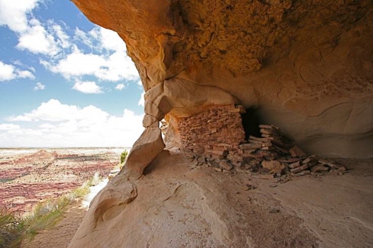
We did see ancestral Puebloan art and ruins here more than any park we had visited up until then. On the Aztec Butte Trail, there are ancient ruins, including a granary along a narrow ledge overlooking a valley.
En route to the Needles district along Route 211, we stopped at a dazzling display of petroglyphs etched on a rock. Newspaper Rock State Historic Park preserves the panel that represents the work of the ancient Puebloan, Navajo, and Mormon settlers. There is even some contemporary graffiti. The rock is now fenced off to prevent vandalism. The term “newspaper” was used to describe possible stories that the ancients carved on the rock.

Geology notes: Canyonlands lays bare over 300 million years of sedimentary rock. The broad plateau visible from the Grand View Overlook is the White Rim sandstone. It serves as a hard cap that prevents faster erosion of the layers underneath, giving the canyons their distinctive appearance. There are vast salt deposits underground as there are throughout this part of the Southwest, an indication that the area used to be submerged in ancient seas.

Leave a comment